Ionospheric TEC Estimate
![Latest Global TEC map from JPL]()

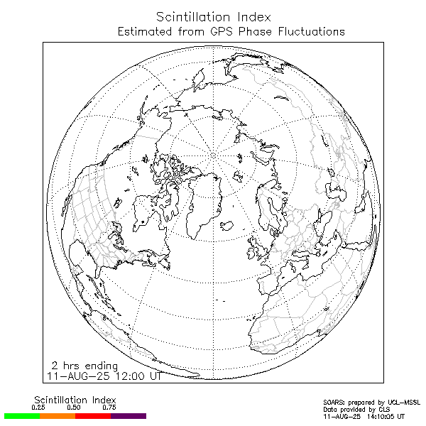
Ionospheric Scintillation (recent data)
POES Auroral Activity Estimate


| Space weather Operational Airline Risks Service (SOARS) |
| Home | HF Comms. | SatCom/SatNav | Radiation || SpW Summary | Solar Images | Links |
|
Ionospheric TEC Estimate
|
Ionospheric Scintillation (recent data)
POES Auroral Activity Estimate
|
Satellite communication and navigation systems are both affected by
conditions in the ionosphere:
[more]
The map on the upper left shows the Total Electon Content derived from GPS observables (produced by JPL); the map on the upper right shows where scintillation recently occurred, derived from GPS phase fluctuations (data supplied by CLS and processed by UCL-MSSL). The lower left plot shows the latest satellite environment data and the map on the lower right shows auroral activity estimated from POES data (both plots produced by NOAA/SEC). Disturbances in the satellite environment can result in geomagnetic storms. |