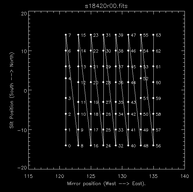
Rasters are generated on CDS by moving the scan mirror between exposures for the NIS and by moving both the scan mirror and slit assembly for the GIS. The nominal steps of these are 2" and 1" respectively though the more precise values are 2.03" and 1.01". The maximum range in both axes is 240"
During a raster, the scan mirror moves from West to East and, if applicable, the slit moves from South to North. To see the locations of each exposure in a raster try:
A typical example for a GIS raster is shown here.
When using any of the long slits with NIS, the routine mk_raster allows the raster designer to limit the number of data that are extracted along the slit, although the extracted data must still be centred on the centre of the slit. This has the effect of limiting the areal coverage of the raster and of course reducing the amount of data to be telemetered to the ground.