Ionospheric TEC Estimate (From JPL)

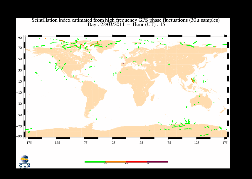
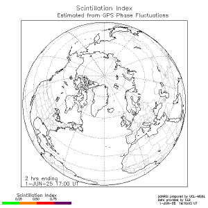
Scintillation Map (From CLS)
Ionospheric Scintillation (recent data)
POES Auroral Activity Estimate


| Space weather Operational Airline Risks Service (SOARS) |
| Home | Links || D-Reg. Abs. | TEC & Scint. | Radiation || SWx I | SWx II | Solar Images |
|
Ionospheric TEC Estimate (From JPL)
Scintillation Map (From CLS)
|
Ionospheric Scintillation (recent data)
POES Auroral Activity Estimate
|
|
TEC maps (IPS/DLR): [Europe] [N. America] [N. Pole (Yest.)] In-situ: [ACE RT MAG & SWEPAM] Polar Maps: [1] [2] [3] |
|
Satellite navigation and communication systems are both affected by
conditions in the ionosphere:
[more - science]
• Position resolution provided by satellite navigation systems can be degraded by high total electron content (the signal is refracted causing timing errors) and by scintillation (the receiver can loose lock). • At mid-latitudes, electron density gradients can be quite large during geomagnetic storms causing additional problems for satellite based augmentation systems (there are too few reference receivers to characterise the gradients). The map on the upper left shows the Total Electon Content
(TEC) derived from GPS observables (produced by JPL); the map on the
upper right shows where scintillation recently occurred,
derived from GPS phase fluctuations (data supplied by CLS and
processed by UCL-MSSL).
The lower left map shows the a movie of scintillation over
the last 24 hours (produced by CLS) and the map on the lower
right shows auroral activity estimated from POES data (both
plots produced by NOAA/SEC).
|