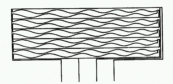
GIS - The SPAN
The SPAN (SPiral ANode) is a novel anode concept which enabled the 11 bit
position of the MCP events to be encoded using the output from two 8 bit ADC's.
The use of the SPAN in GIS has resulted in a certain amount of
complexity in the data which was due to
electronic noise. This noise causes uncertainty in the 8 bit measurements
by the ADC's, and
results in
GHOSTING